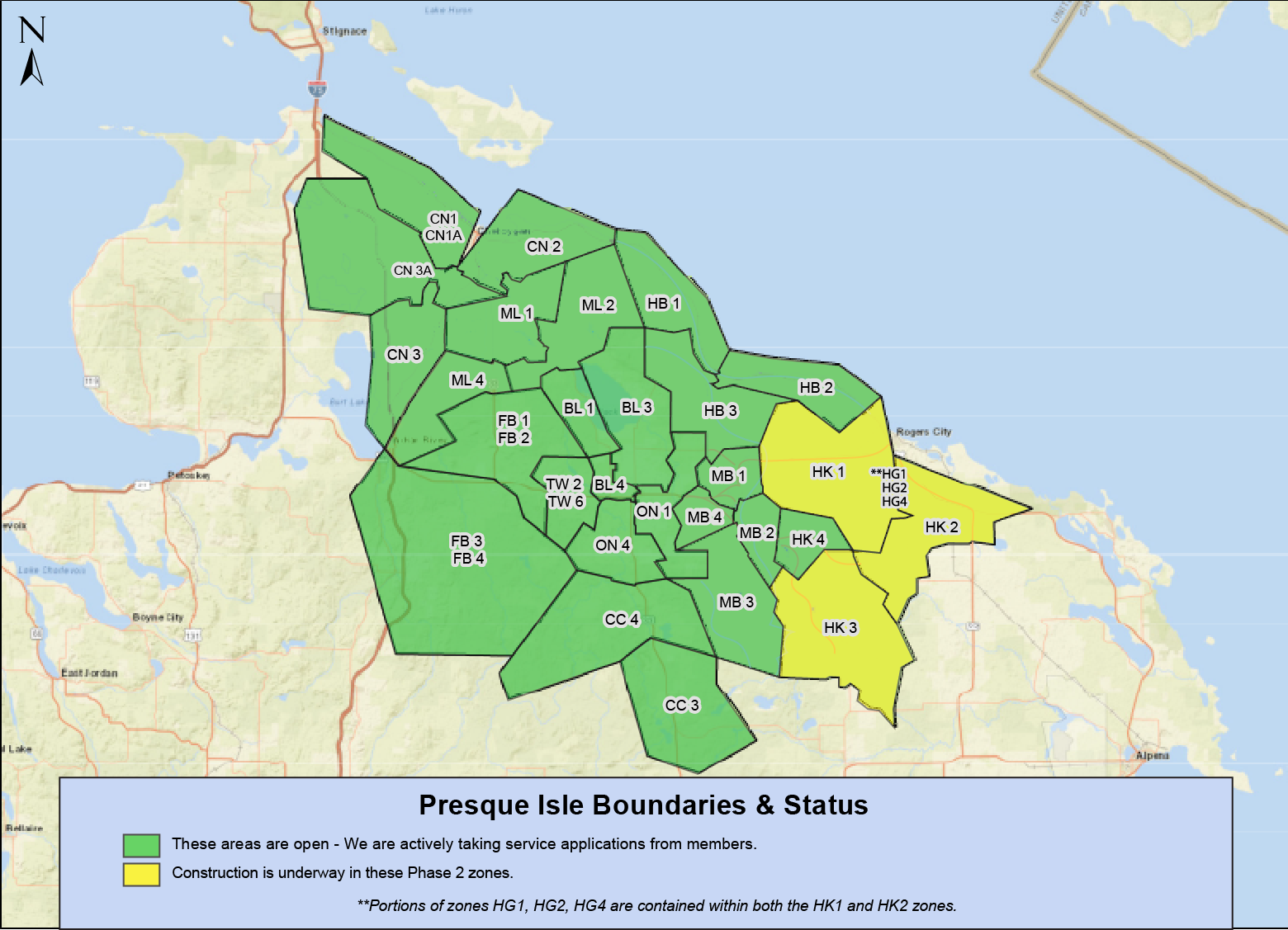
PIE&G Connect Fiber Construction Status Map
PIE&G Connect is now connecting members across several communities, with more being added each month! Please see the status map below to see our fiber-to-the-home network schedule for Phase 1 zones of our project. We will update additional phases as the network progresses. Scroll to the bottom of this page to see how you can determine your zone.

Currently accepting applications from members in these communities:
Afton Black Lake
Canada Creek Cheboygan
Fingerboard Hammond Bay
Indian River Millersburg
Mullet Lake Ocqueoc
Onaway Topinabee
Tower Wolverine
PIE&G Connect is building our fiber network by zones or phases, a path that follows our electric infrastructure.
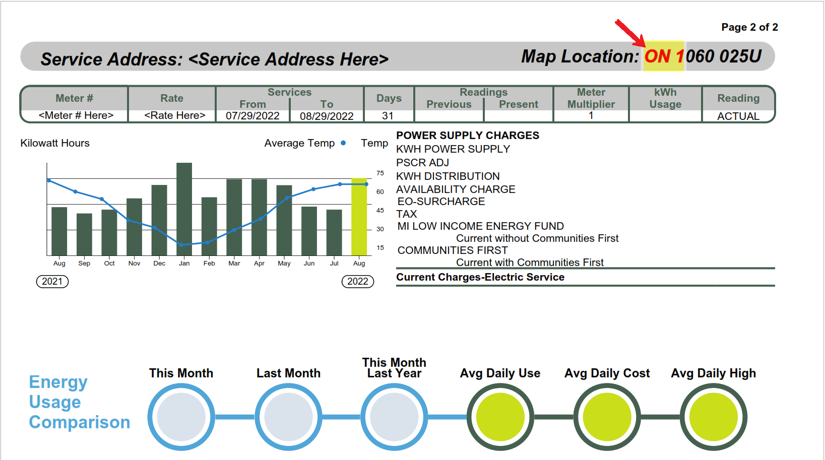
To find the substation you reside in, and the corresponding timeline, please see the first two letters of your “Map Location” listed on your billing statement as below, and compare it to the substation abbreviations on our status map above.
*Please note: the map above reflects only Phase 1 and Phase 2. If your substation is not noted in the current map, it will be reflected in later phases.
